WAYFINDING
Wayfinding can be defined as spatial problem solving. It is knowing where someone are in a building or an environment, knowing where your desired location is, and knowing how to get there from your present location.
Process of wayfinding involves the same four stages:
Orientation - to specify a location relative to nearby object and destination and to improve orientation, dividing the space into different chunks, using signs and signboards to create unique subspace.
Example: The map of Level G, FSKPM.
Source: Both figure 1 & 2 were taken at Level G, FSKPM
Explanation:
This map shows all the rooms and labs for level G of FSKPM in small rectangular boxes. It even uses signs, texts and colours to indicate the location and to name them.
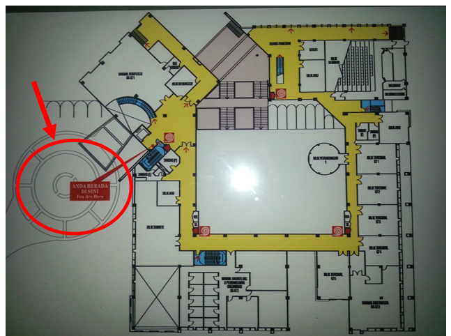
Figure 1: The overall view of the map
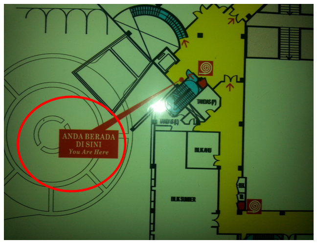
Figure 2: Zooming in, you can see your current location on the map which is able to increase your mobility.
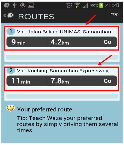
Route Decision - to select the path to reach the destination and to improve the route decision making, reduce the number of navigation options, and provide signs or prompt in point results.
Example: Routes Choices from Waze
Source: Screenshot from the Waze application
Explanation:
In Waze application, a user is able to view all possible routes to go to a destination and they are given the choice to choose the route the preferred.
Example: Routes Choices from Waze
Source: Screenshot from the Waze application
Explanation:
In Waze application, a user is able to view all possible routes to go to a destination and they are given the choice to choose the route the preferred.
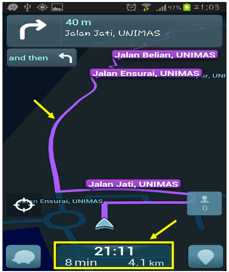
Route Monitoring - to monitor a selected to confirm that it is leading to the destination and to improve monitoring of the routes, connecting with route with clear beginnings, middles and ends.
Example: Waze application user interface
Source: Screenshot from Waze application
Explanation:
Waze monitors its users' location and journey by providing its users with length of the journey, the time taken to reach a desired destination and the end time of the whole journey.
Example: Waze application user interface
Source: Screenshot from Waze application
Explanation:
Waze monitors its users' location and journey by providing its users with length of the journey, the time taken to reach a desired destination and the end time of the whole journey.
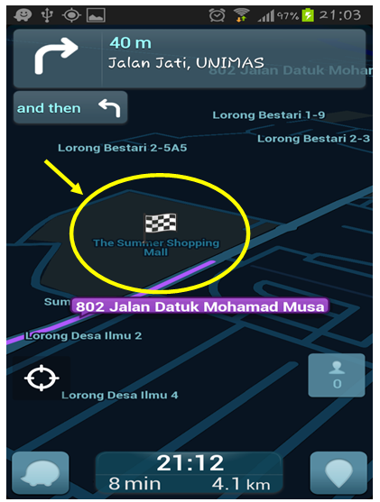
Destination Recognition - to recognize the destination and enhance recognition of the destination . For example in this design checkered black and white flag signifies the destination.
Example: Waze application user's interface
Source: Mobile screenshot from the Waze application
Explanation:
There is a flag with black and white boxes which indicates that the user has reached his or her destination.
Example: Waze application user's interface
Source: Mobile screenshot from the Waze application
Explanation:
There is a flag with black and white boxes which indicates that the user has reached his or her destination.